
The old Runcorn that sits within the shadow of the Silver Jubilee Bridge is likely to face change, yet again.
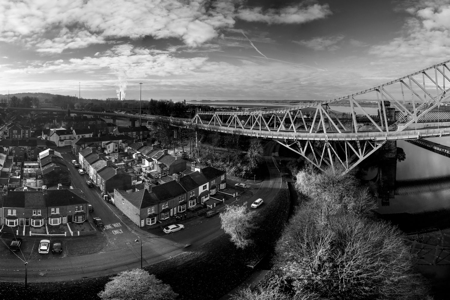
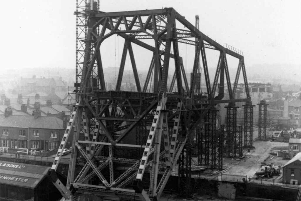
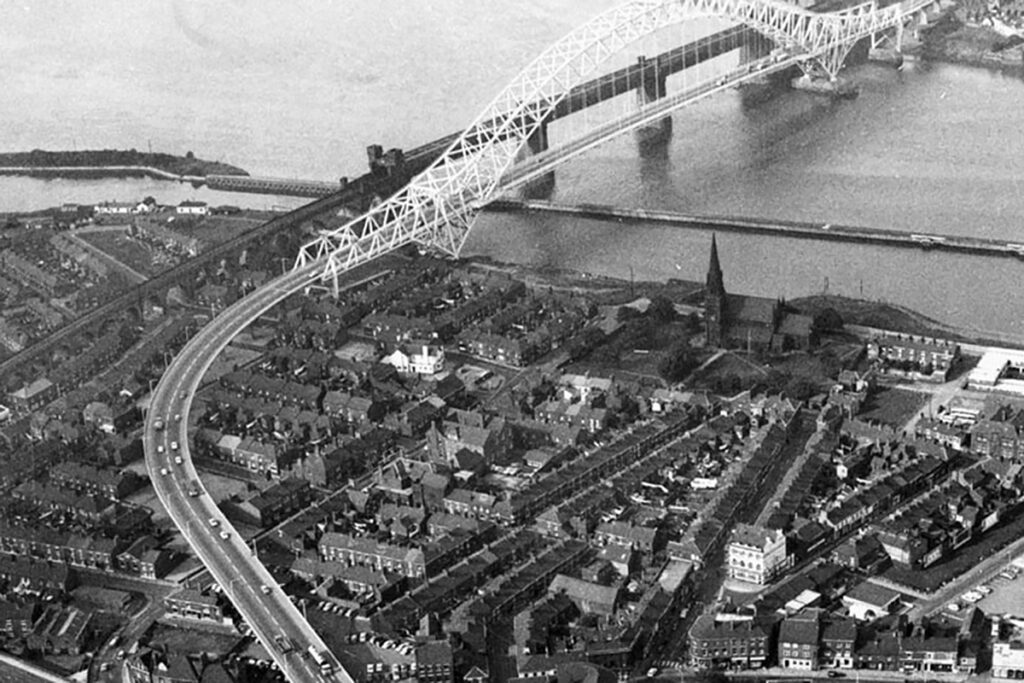
In November 1960 the two sides of the cantilevered steelwork that had sprouted from the shores of Widnes to the north and Runcorn to the south banks of the Mersey to a height of 87m, met in mid-air to complete a single main arch of 330m. Up close, it is still an impressive sight today, but a walk around the streets surrounding the main construction area demonstrate how the effects of road building can be brutal to any environment, unsympathetic to what has gone before and deprive the residents adjacent to it of large amounts of light and air.
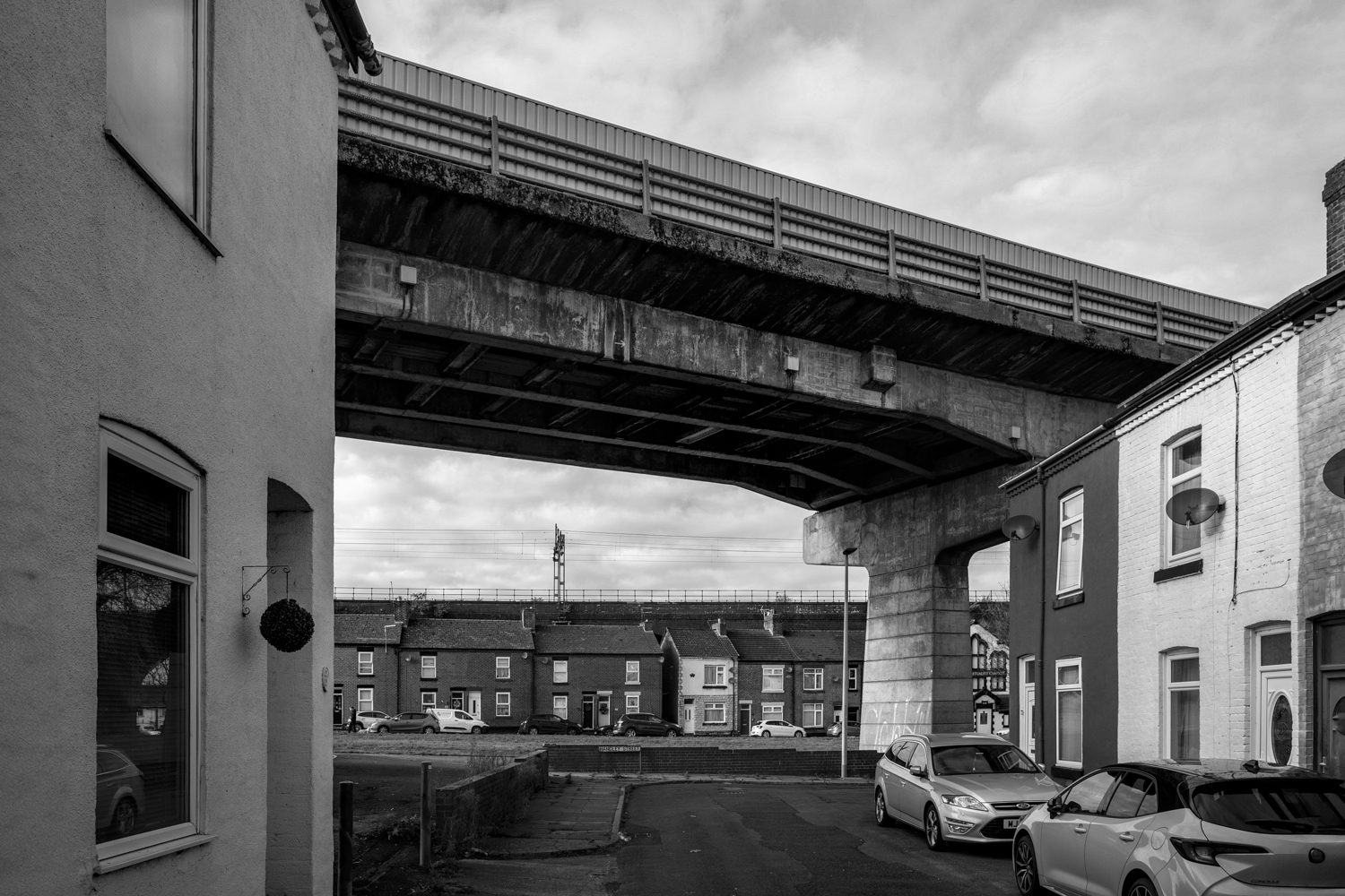
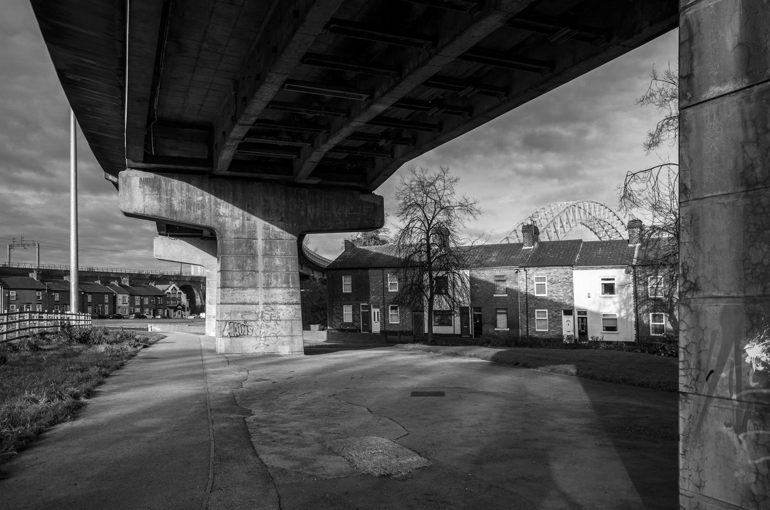
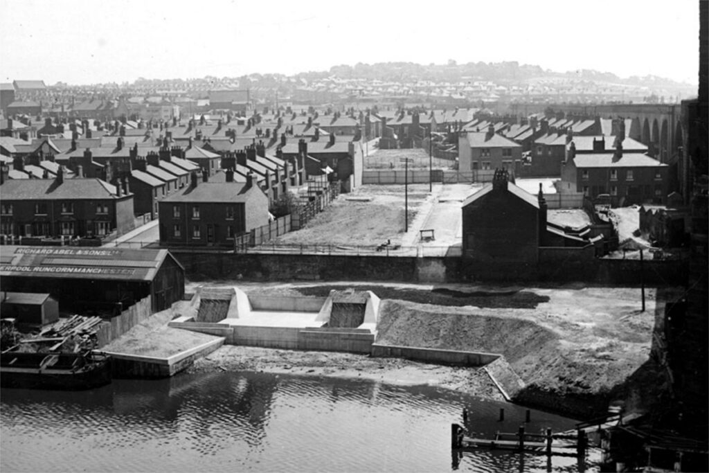
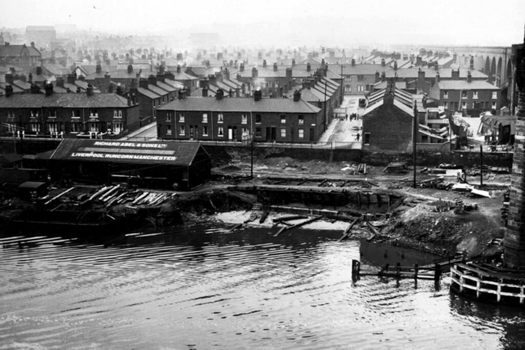
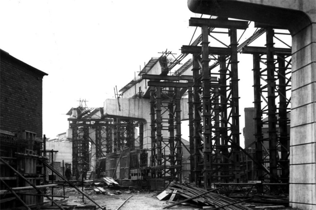
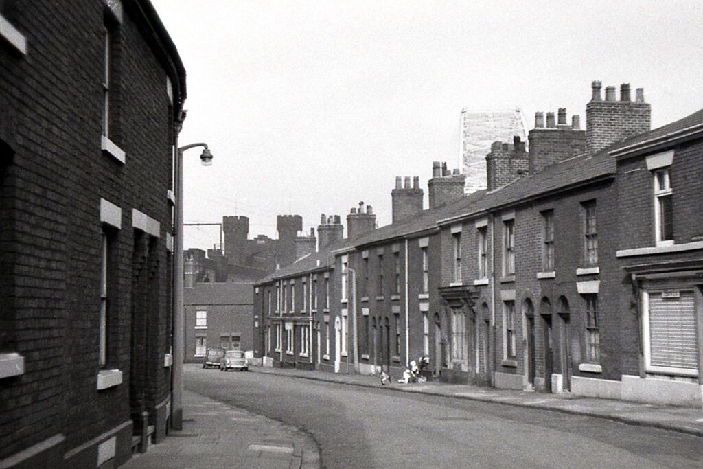
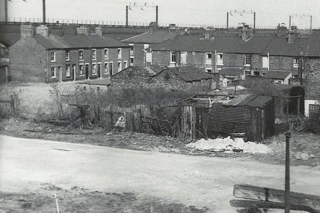
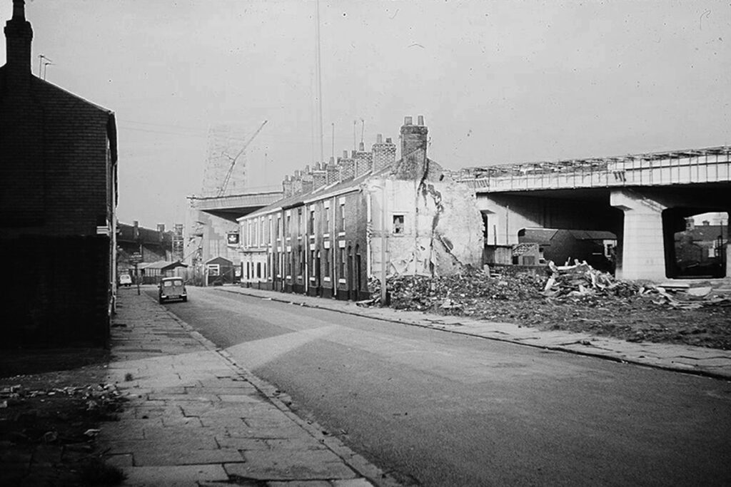
At ground level, land was cleared from April 1956 through to 1958 by contractors Leonard Fairclough of Adlington to accommodate the site work offices, construction of pilings and footings, steel for the bridge and concrete production for the road approaches. In Runcorn, a 500m stretch of flyover (viaduct) was constructed to take the two-lane road over the Bridgewater Canal and the Old Town to the bridge approach. To keep costs down, the minimum number of compulsory purchases had been made which in turn created a lack of working space for the contractors, close proximity of some of the houses to the finished road and living conditions that some residents described as a “battlefield”. Such proximity is all too visible today. At best, the large expanses of concrete flyover provide an umbrella for protection but at worst cast long deep shadows across neighbouring properties for significant parts of the day.
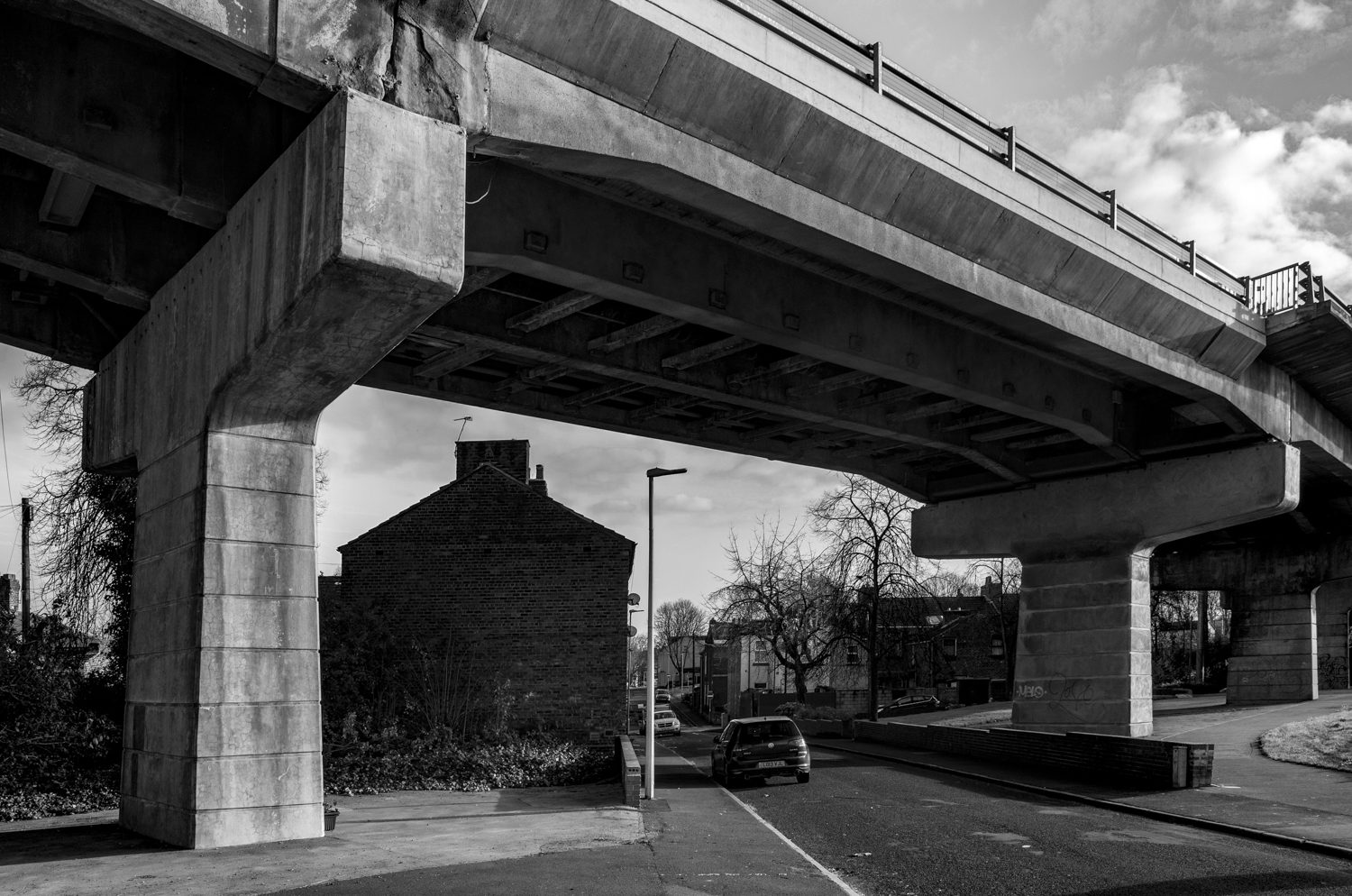
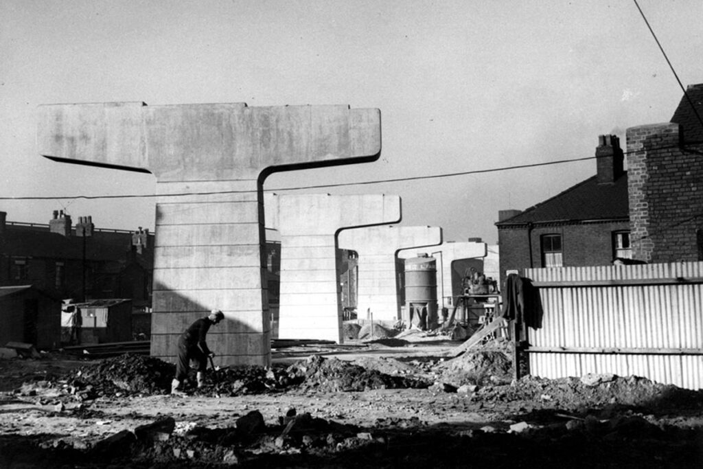
This first phase of the approach carriageways in February 1960 required fourteen spans on the Runcorn side but only six in Widnes. These spans were supported by vast 10m high “T” shaped concrete piers (pillars) that supported the 38-ton reinforced concrete beam deck. Together with the phase two widening to four lanes during 1975-77 (that lead to the reopening as the Silver Jubilee Bridge in 1977) the approach road construction in Runcorn would involve the demolition of some 225 mainly Victorian homes and the end of the community history of hundreds of families.
A short list of the streets demolished between 1956 and 1977.
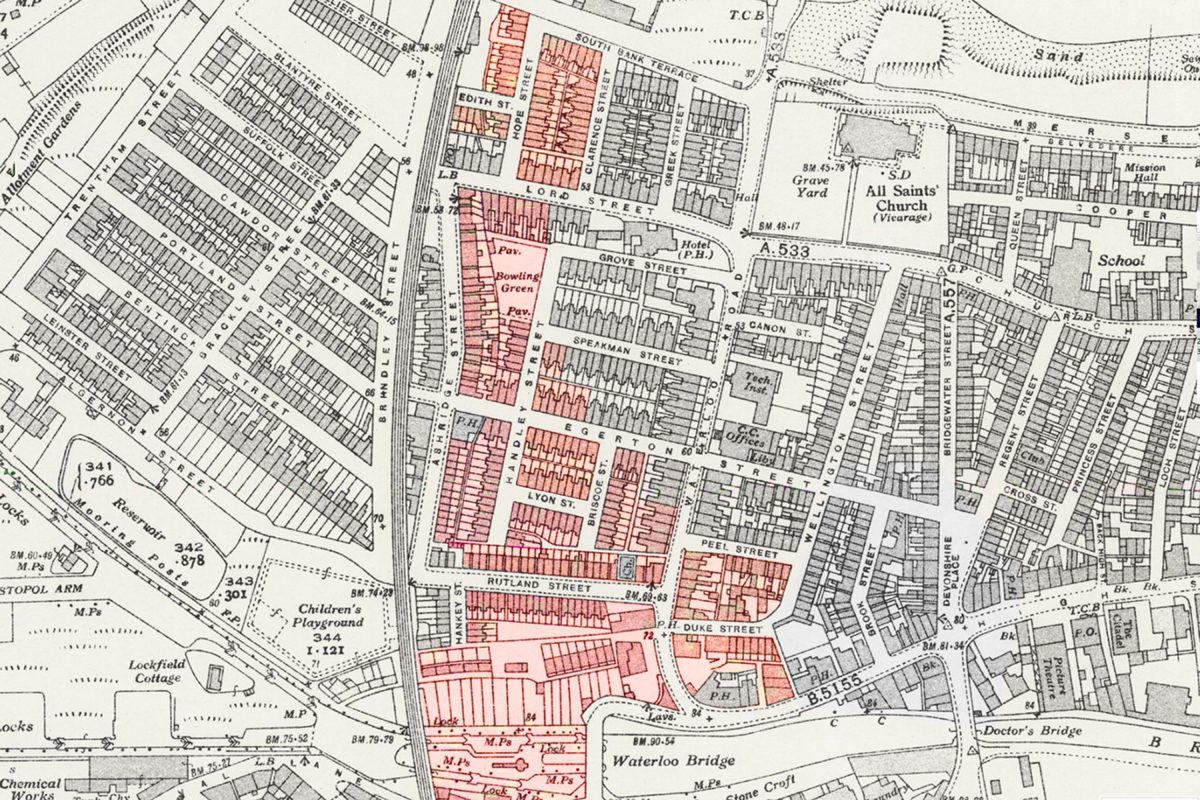
South Bank Terrace: 8 properties. Bought with a Compulsory Purchase Order and demolished partly 1958-1960 then completely in 1975.
Clarence Street: 21 properties. Bought with a Compulsory Purchase Order and demolished partly 1958 then completely after 1975 in order to accommodate the site offices of the new flyover.
Hope Street: 14 properties. Bought with a Compulsory Purchase Order and demolished 1958-1960.
Edith Street: 4 properties. Bought with a Compulsory Purchase Order and demolished 1958-1960.
Lord Street (part): 15 properties. Bought with a Compulsory Purchase Order and demolished 1958-1960. Initially number 27 remained intact but was then demolished some time after 1961.
Ashridge Street – west: 36 properties (including Archie Johnson’s the bakers – of Johnson’s pies fame -, Parr’s, Miss Lee’s corner shop, and the Bridge Hotel.
Speakman Street (part): 3 properties. Bought with a Compulsory Purchase Order and demolished 1958-1960. The street was named after the shipbuilder Philip Speakman.
Egerton Street: 16 properties. The loss of (Dicky) Briscoe’s Butchers and surrounding houses by compulsory purchase in 1973. Initially Egerton Street is named after Francis Egerton, 3rd Duke of Bridgewater.
Handley Street / corner of Egerton Street: 13 properties. The loss of the bowling green, Robert’s grocery, Noon’s chippy, Brenda Newtons grocery and surrounding houses bought with a Compulsory Purchase Order in 1973 and demolished during 1975. Handley Street was named after William Handley, former Chairman of both the Runcorn Improvement Commissioners and their successors, the Runcorn Urban District Council. Also, a well-respected local historian.
Briscoe Street: 10 properties. Bought with a Compulsory Purchase Order and demolished 1958-1960.
Lyon Street: 10 properties. Bought with a Compulsory Purchase Order and demolished 1958-1960. Lyon Street was named after William Lyon, former Chairman of the Runcorn Urban District Council.
Rutland Street: 46 properties including the corner Hankey St. Home to the Welsh Chapel which came close to being demolished during the 1950s for the construction of the initial bridge approach road.
Duke Street / Peel Street / Waterloo Street: 28 properties.
In 2020 the West Viaduct (known as the “Trumpet Loop”) was demolished as part of the de-linking strategy for the Jubilee Bridge since the construction of the Mersey gateway bridge in 2017. Although ear-marked for leisure and retail, the land currently remains unused. Considering what was there before, there is likely archaeology not far from the surface of the topsoil – basements in-filled, spoil heaps and demolition material. With the stalling of the HS2 extension which forms a significant part of the redevelopment plans for the immediate area, there might be an opportunity to extract some stories from the soil before the diggers and concrete mixers move in for the fourth time in 60 years.
Photographs
There are two galleries below. The first are contemporary aerial and ground images taken in November 2023. The second are historical images of the streets demolished and I have cited these sources as fully as possible but of course welcome any amendments or requests for removal.
.
Historical photographs taken between 1956 and 1977:
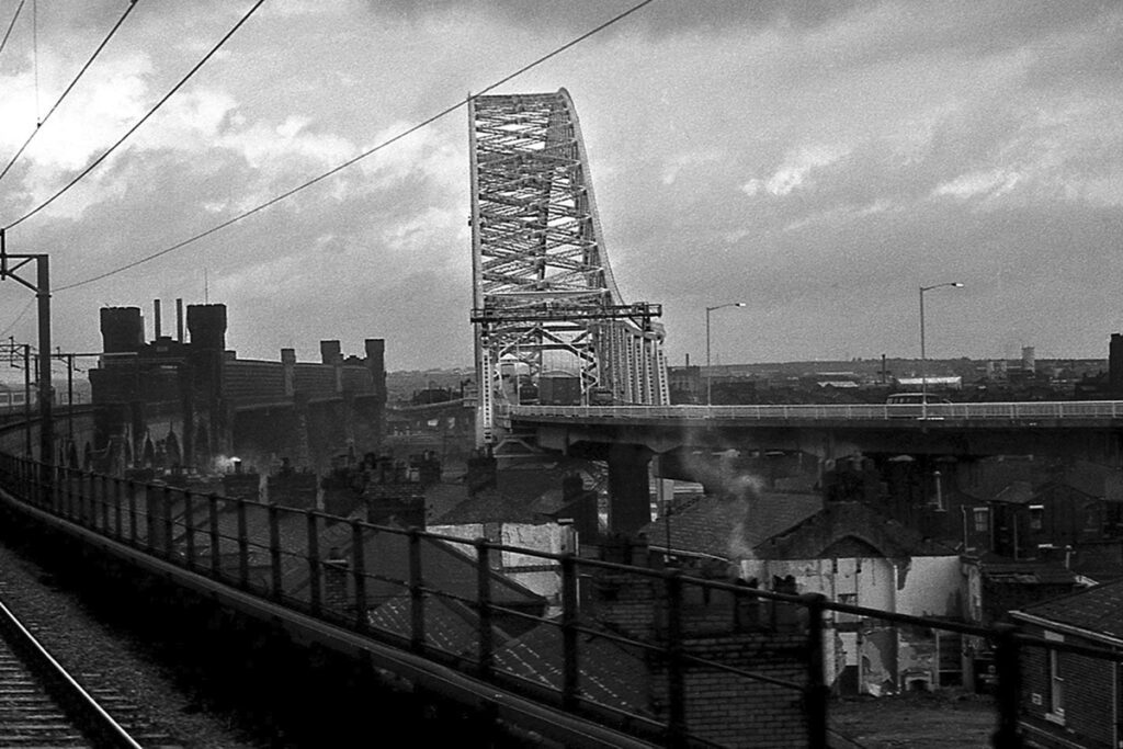
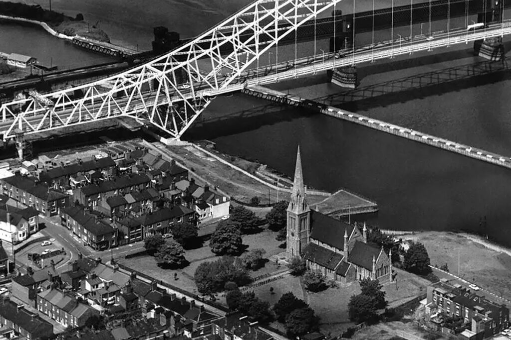
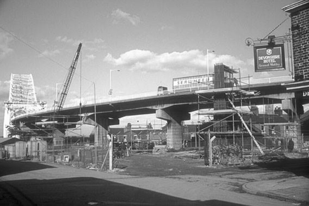
Contemporary image copyright Tim Stubbings 2023. Sources for and additional material (including historical images) are listed further below.
https://www.icevirtuallibrary.com/doi/pdf/10.1680/iicep.1965.9195
Facebook – The development of Runcorn to a New Town: https://www.facebook.com/groups/288012877904790
Facebook – Stuart Allen: https://www.facebook.com/stuart.allen.3538
Facebook – Andy Price: https://www.facebook.com/photo/?fbid=3468643044804&set=gm.352597834779627&idorvanity=288012877904790
Facebook – Stephen Dowle: https://www.facebook.com/photo/?fbid=2254984961279548&set=gm.1158413244353787
Andy Harmer / Stuart Allen: https://www.facebook.com/photo/?fbid=1121750428210279&set=pcb.483567795361882